Polar vs Geostationary Weather Satellites: Why We Need Both
One class scans changing strips of Earth; the other watches the same hemisphere continuously. Together they strengthen forecasting.
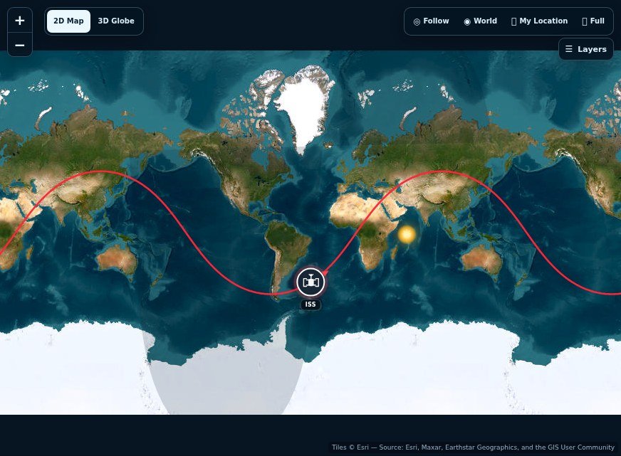
The distinction becomes clear when you compare how the two orbit types view Earth. A geostationary spacecraft keeps nearly the same region in view, while a polar-orbiting spacecraft repeatedly sweeps across different parts of the planet. The tracker shows the orbital geometry behind those different observing strategies.
Two useful viewpoints
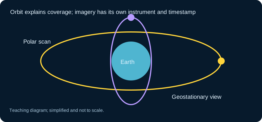
Weather forecasting needs both global detail and rapid regional updates. Polar-orbiting spacecraft circle at comparatively low altitude and pass over different ground on successive orbits. Geostationary spacecraft operate far higher above the equator and match Earth’s rotation closely, allowing them to watch a broad region continuously.
What a polar ground track looks like
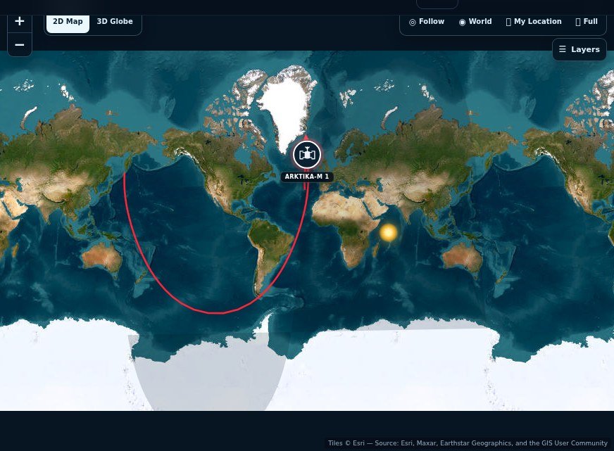
On a live map, a polar-orbiting satellite sweeps north and south while Earth rotates beneath it. Over time, successive passes build coverage across the globe. The lower orbit can support detailed measurements, but the satellite is not permanently visible from one ground location.
Why GOES seems almost still
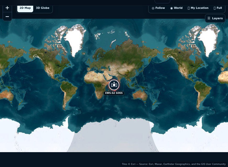
A geostationary satellite’s orbital period matches the rotating Earth and its orbit is aligned with the equator. From the ground it appears near a fixed direction in the sky. Its tracker therefore looks very different from a fast low-orbit path. Small motion or an inclined orbit can still appear, so “geostationary” should not be confused with physically motionless.
Forecasting roles overlap
Polar systems supply valuable global atmospheric, ocean and surface observations. Geostationary systems repeatedly image storms, clouds and rapidly changing conditions across their assigned view. Meteorologists combine these streams with radar, surface measurements and numerical models rather than relying on a single satellite picture.
Choose the tracker for the question
Use the weather directory when you want to explore individual low-orbit spacecraft and local passes. Use the GOES tracker when you want to understand a nearly fixed orbital slot and hemispheric monitoring. The contrast is an accessible demonstration that an orbit is part of an instrument’s observing strategy, not merely a route to space.
Choose the observation before choosing the orbit
If you want to watch a storm evolve across one region, frequent repeated images can be valuable. If you want broad global measurements, a spacecraft that scans successive areas as Earth rotates beneath it offers a different advantage. These needs help explain why weather systems use more than one orbit type. Neither class is a universal replacement for the other.
Imagine following a storm during an afternoon and studying a global temperature pattern over a longer interval. The first question benefits from a regular regional view; the second draws on observations across much wider coverage. The instrument, spectral band and product processing still matter in either case. An orbit tells you how coverage is acquired, but it does not by itself tell you what physical quantity an image measures.
A geostationary view still has a footprint
A geostationary spacecraft appears near a fixed direction from the ground because its orbit matches Earth's rotation appropriately. It does not see every point on the globe equally well. Locations toward the edge of its visible disk are viewed at a more oblique angle, and the poles are not served in the same way as the central part of the scene.
This explains why a full-disk image is not a flat photograph of the whole Earth. The curved boundary and perspective are part of the geometry. If you compare regional products, check coverage and viewing angle instead of assuming every area has identical resolution. A tracker can help locate the platform, but the official image product explains which part of the atmosphere or surface is represented and when the observation was made.
Polar coverage builds from successive scans
A polar-orbiting weather spacecraft follows a low-orbit path that gives it changing ground coverage as Earth turns. Its instruments collect observations along successive swaths rather than holding a permanent view over one longitude. A single pass supplies one part of a broader coverage pattern. Over time, those measurements contribute to global products and forecasting systems.
Do not confuse the drawn orbit line with the exact instrument swath. The width and sampling depend on the instrument and product. Likewise, a catalog's geometric pass over your city is not necessarily the acquisition time of a particular weather image you are viewing. Read product timestamps and metadata when relating the orbital path to the observations. That distinction prevents a static map background from being mistaken for the selected satellite's newest cloud picture.
Visible and infrared products answer different questions
A visible-light image depends on illumination and can look familiar because it resembles ordinary photography. An infrared product represents measurements in a different part of the spectrum and may use a colour scale to communicate temperature-related information. Both are useful, but a coloured infrared scene should not be interpreted as the landscape's natural appearance.
For a practical comparison, choose official products with clearly labelled times, regions and bands. Examine what each product is intended to show before looking for differences. The tracker adds spatial context for the platform; the provider's product page supplies the weather observation. Used together, they explain why forecasting benefits from complementary viewpoints. Used interchangeably, they create the false impression that any satellite icon over a region is displaying the current weather below it.
One storm, two kinds of observation
Suppose a large weather system develops over the ocean. A geostationary instrument can repeatedly examine the same broad region, helping forecasters see how cloud patterns and storm structures change. A polar-orbiting instrument travels along a moving path and can bring different measurements, spatial detail or complementary spectral coverage. The value of the two systems comes from combining their strengths, not choosing a single winner.
A visible satellite image depends on sunlight, whereas some infrared observations can be made through day and night. Colours on an enhanced weather product often represent temperature or another measured quantity rather than natural light. For that reason, the legend and timestamp are as important as the attractive image. A tracker icon shows where the spacecraft is; it is not a direct view of the product its sensors captured.
What the orbit map reveals—and what it leaves out
Open a polar weather satellite and a GOES geostationary spacecraft on the same day. The polar satellite moves around the globe, and its ground track shifts with Earth's rotation. A geostationary spacecraft stays near a fixed longitude in the map view, though actual station-keeping and orbital variations still matter. These patterns help explain revisit frequency without showing a full instrument scanning footprint or ground processing pipeline.
For operational weather interpretation, turn to NOAA NESDIS or another official meteorological provider. Their product documentation specifies the sensor, channels, update time and limitations. Use SpaceTracker's weather directory for the orbital side of the story, while treating forecasts and warnings as the domain of weather agencies.