
TRACKER GUIDE & MISSION EXPLAINER
NOAA-19 Tracker: Polar Orbit, Mission History and Map Guide
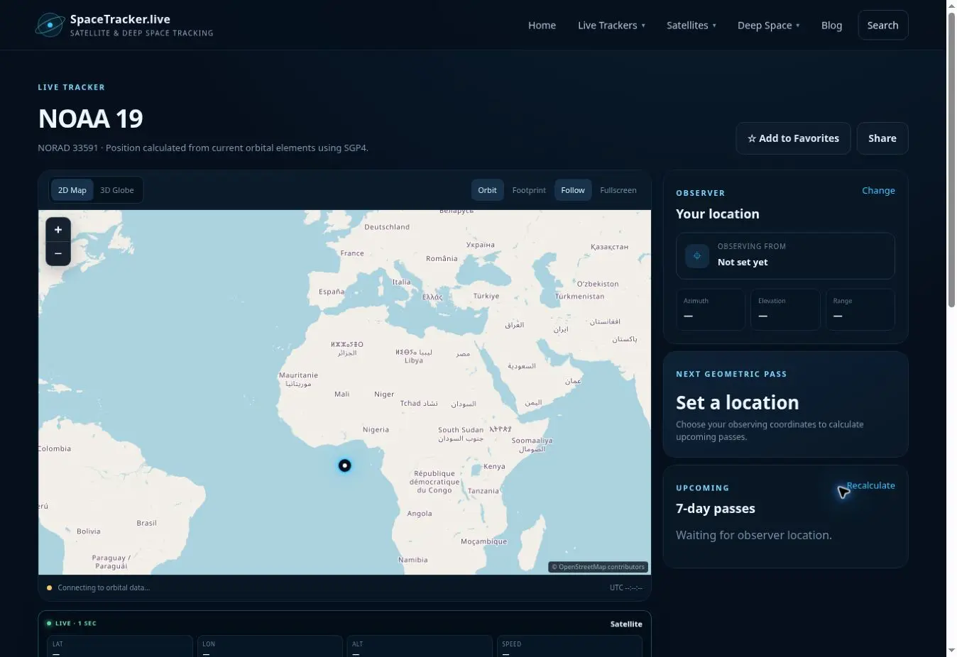
NOAA-19 is a polar-orbiting environmental satellite launched in 2009 under the prelaunch name NOAA-N Prime. The tracker above follows its calculated orbit even though NOAA decommissioned the spacecraft in August 2025. A retired satellite remains an object in orbit and can therefore still have a valid catalog record and propagated ground track.
This distinction matters: orbital tracking does not mean that a spacecraft is operational or returning science data. The page shows where the object is estimated to be, not the status of its instruments or services.
NOAA-19 and the POES programme
NOAA-19 belonged to the Polar Operational Environmental Satellites family. Polar-orbiting weather spacecraft repeatedly cross high latitudes while Earth rotates beneath them, allowing successive passes to sample different swaths of the planet. Their instruments historically supported atmospheric sounding, cloud and surface observations and other environmental measurements.
NOAA identifies the August 2025 retirement of NOAA-19 as part of the conclusion of the long-running POES mission. Newer polar systems continue the environmental-observing role, but NOAA-19 remains historically important for its years of service.
How the NOAA-19 tracker works
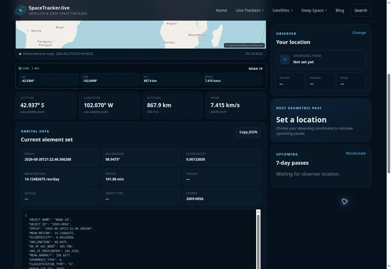
The current element set is propagated with SGP4 to estimate position, velocity and the sub-satellite point. A near-polar, sun-synchronous-style orbit produces a very different map pattern from a geostationary GOES satellite: the marker moves rapidly north and south while Earth rotates below.
The map can continue to function as long as suitable orbital elements are available. The tracker does not infer whether transmitters are active. It also cannot determine whether the satellite is producing usable weather observations.
How to use the page
- Follow the ground track across high northern and southern latitudes.
- Compare the roughly low-Earth-orbit altitude with the much higher GOES-19 orbit.
- Set your location to inspect azimuth, elevation and geometric passes.
- Read the data-source epoch to understand how recent the orbit description is.
- Treat any radio reception or instrument-status question separately from orbital position.
What this teaches about weather satellites
A constellation of polar and geostationary spacecraft gives meteorologists complementary views. Geostationary satellites watch one broad region frequently; polar orbiters gather global swaths and vertical atmospheric measurements from much closer to Earth. Tracking the two orbit types makes that observing strategy easier to understand.
NOAA-19 is also useful for teaching satellite life cycles. Launch, commissioning, operations, retirement and eventual orbital decay are separate phases. A catalogued object can remain trackable long after its operational mission ends.
Accuracy and status warning
Do not interpret the presence of live coordinates as evidence that NOAA-19 is an active weather satellite. SpaceTracker.live calculates orbit only. Official NOAA pages should be used for operational fleet status and environmental products.
Frequently asked questions
Is NOAA-19 still operational?
NOAA decommissioned NOAA-19 in August 2025. The object remains in orbit and can still be mathematically tracked.
Why is a retired satellite shown on a live tracker?
Live refers to the time of the orbit calculation, not to mission or instrument status.
What is a polar-orbiting weather satellite?
It travels in a high-inclination low Earth orbit, collecting swaths over different parts of Earth as the planet rotates beneath it.
Does this tracker provide NOAA weather forecasts?
No. It shows orbital position. Use official meteorological services for forecasts and warnings.
Sources and further reading
- NOAA: POES constellation decommissioned
- NOAA: History of NOAA satellites
- WMO: Polar and geostationary observing roles
- CelesTrak orbital data
Educational-use note: SpaceTracker.live is an independent educational website and is not an official mission-control service. Positions, paths, distances and pass predictions are computed from third-party orbital elements or ephemerides. They may be delayed or approximate and must not be used for navigation, collision avoidance or safety-critical decisions.