
TRACKER GUIDE & MISSION EXPLAINER
GOES-19 Tracker: Understanding the GOES East Weather Satellite
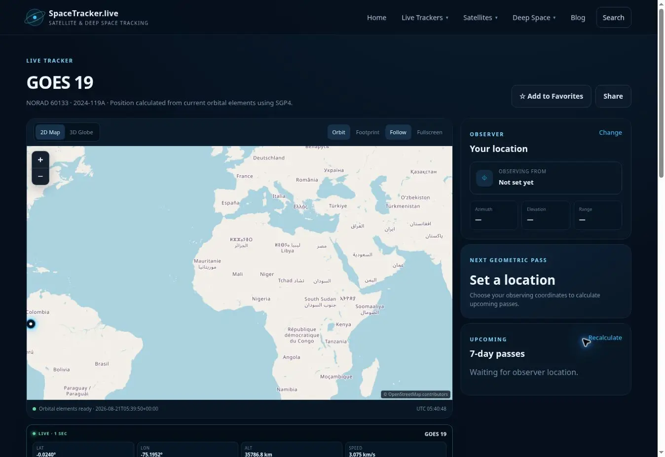
GOES-19 is NOAA's operational GOES East spacecraft. Unlike a low-orbit satellite that races across the map, a geostationary satellite circles Earth once per sidereal day above the equator and therefore remains close to one longitude. The tracker above helps explain that special orbit through calculated position and orbital data.
GOES-19 began as GOES-U, the fourth and final spacecraft in the GOES-R series. It launched on June 25, 2024 and entered operational service as GOES East on April 7, 2025. Its vantage point supports continuous monitoring of the Americas, the Atlantic and nearby regions.
What GOES-19 observes
The GOES-R series provides advanced imagery, atmospheric measurements, lightning mapping and space-weather observations. From geostationary orbit, GOES-19 can repeatedly observe the same broad region, making it valuable for following rapidly changing clouds, hurricanes, severe storms, wildfires and other hazards.
GOES-19 works with GOES-18, the operational GOES West spacecraft. Their coverage is designed for weather operations rather than public satellite spotting. The tracker is educational: it visualises the orbit of the spacecraft, while official NOAA products turn its instrument measurements into imagery and forecasts.
Why the marker appears almost stationary
A geostationary orbit is a circular, equatorial geosynchronous orbit at roughly 35,786 kilometres altitude. Matching Earth's rotation allows the spacecraft to stay over nearly the same longitude. Small station-keeping motions and element-set differences mean the computed marker may still drift slightly.
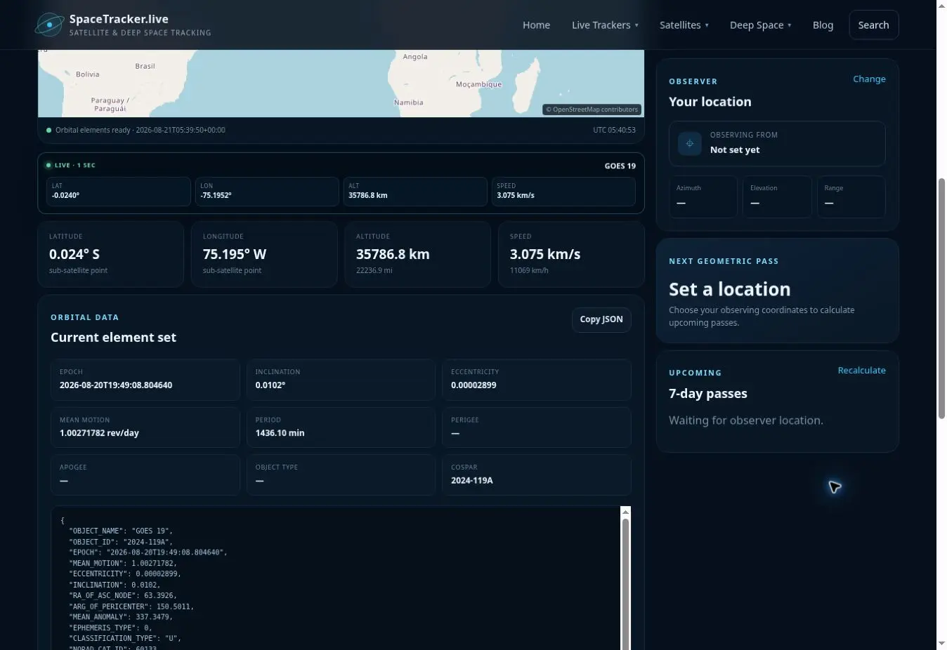
SGP4 can propagate the public element set and convert the result to latitude, longitude and altitude. The displayed speed is orbital speed, even though the ground position seems fixed. This is a useful reminder that stationary on a map does not mean motionless in space.
How to explore this tracker
- Watch longitude over time and compare it with a low Earth orbit tracker.
- Inspect altitude to understand why geostationary spacecraft are much farther away than ISS or NOAA polar orbiters.
- Set an observer location and note that azimuth and elevation change slowly.
- Use the orbital-element panel to identify inclination and eccentricity.
- Open the GOES directory to compare GOES-19 with other members of the fleet.
Educational uses
GOES-19 provides a direct way to teach the relationship between orbital period and altitude. Students can ask why a spacecraft must be above the equator to remain fixed over one longitude and why polar regions are viewed at an angle from geostationary orbit.
The page can also introduce the difference between tracking a spacecraft and using its data. SpaceTracker.live estimates where GOES-19 is; NOAA receives, calibrates and distributes the environmental observations used by meteorologists.
Limits of the display
The tracker is not an official weather-data service and does not replace NOAA imagery, alerts or forecasts. Element sets describe orbit, not instrument health. For hazardous weather decisions, always use warnings and information from the responsible meteorological authority.
Frequently asked questions
Why does GOES-19 stay over nearly the same place?
Its geostationary orbit matches Earth's rotation and lies close to the equatorial plane, so its sub-satellite longitude changes very little.
Is GOES-19 the same as GOES-U?
Yes. GOES-U was the pre-operational name; after launch and reaching geostationary orbit it became GOES-19.
Can this page show live hurricane imagery?
No. It tracks the spacecraft. Official imagery and environmental products are published by NOAA.
Is the satellite actually stationary?
No. It travels around Earth continuously. It only appears stationary relative to the rotating surface.
Sources and further reading
- NOAA: GOES-19 operational as GOES East
- NOAA: GOES-U / GOES-19 mission facts
- GOES-R mission overview
- CelesTrak orbital data
Educational-use note: SpaceTracker.live is an independent educational website and is not an official mission-control service. Positions, paths, distances and pass predictions are computed from third-party orbital elements or ephemerides. They may be delayed or approximate and must not be used for navigation, collision avoidance or safety-critical decisions.