
Curious about the Starlink satellite map? Onspacetracker.live we help you explore live views of SpaceX’s massive constellation. Track real-time positions, spot patterns, and understand how Starlink is changing global internet.
Click Here For Starlink Live Tracker
Have you ever looked up at the night sky and wondered how many human-made objects are actually zipping around up there? If so, the Starlink satellite map is one of the coolest things you can play with right now. SpaceX has launched thousands of these little satellites, and interactive maps let you watch them dance around the planet in real time.
What’s So Special About a Starlink Satellite Map?
Basically, a Starlink satellite map is an online tool that shows you exactly where all those Starlink satellites are at any given moment. We’re talking about more than 9,400 satellites in orbit as of early January 2026 (with thousands actively working to beam internet around the world).
These aren’t static pictures — the best maps update constantly, letting you zoom around the globe, follow individual satellites, check their orbital paths, and even see how the whole network covers different parts of Earth.
Here are a few stunning real-time visualizations that really show off the scale of the constellation:
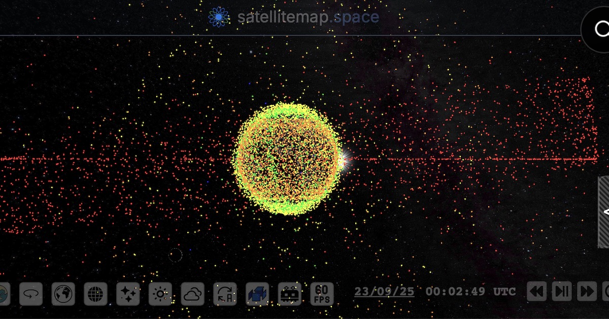

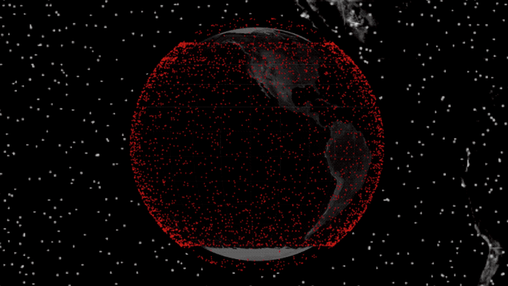
It’s honestly mind-blowing to see how dense the network has become!
Why People Love Tracking Starlink Satellites
Honestly, there are so many reasons to pull up a Starlink satellite map:
- Space geeks (like me) get excited watching the constellation grow with every new launch.
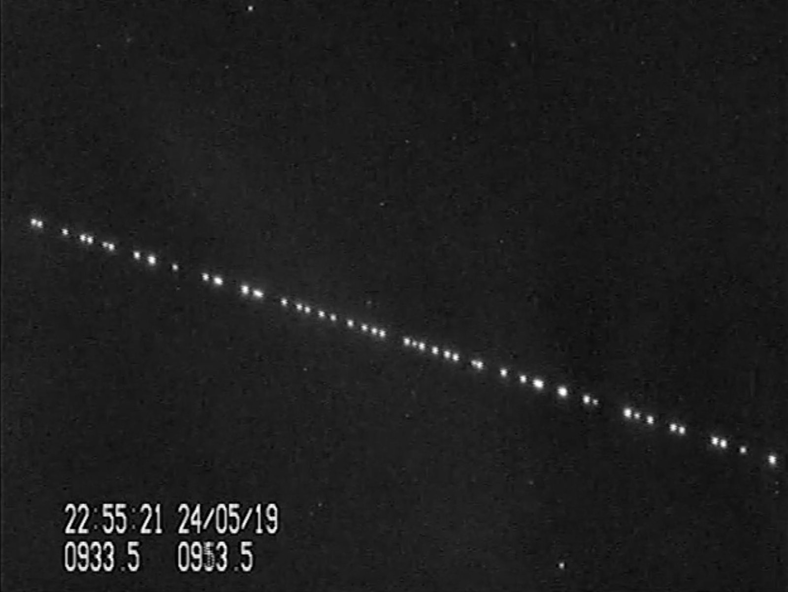
- You can predict when you’ll see those famous “Starlink trains” — bright chains of satellites right after they launch.
- It gives you a real sense of how Starlink delivers internet to remote places.
- Teachers, students, and researchers use it to learn about orbits and modern satellite tech.
With SpaceX launching batches almost weekly and even planning big changes (like lowering many satellites to safer lower orbits in 2026), keeping an eye on the map is more interesting than ever.
Speaking of those beautiful trains — here’s what they look like from the ground:

The Best Starlink Satellite Maps to Try in 2026
There are a few standout options that most people recommend:
- space.tagbuilder.io — Probably the most popular live Starlink satellite map right now. Super detailed, clean interface, and great for seeing the whole picture.
- findstarlink.com — Awesome if you just want to know when satellites will pass over your backyard.
- starlink.sx — Another solid choice with real-time coverage and some extra stats.
(For checking where Starlink internet service is actually available, head over to the official Starlink Availability Map.)
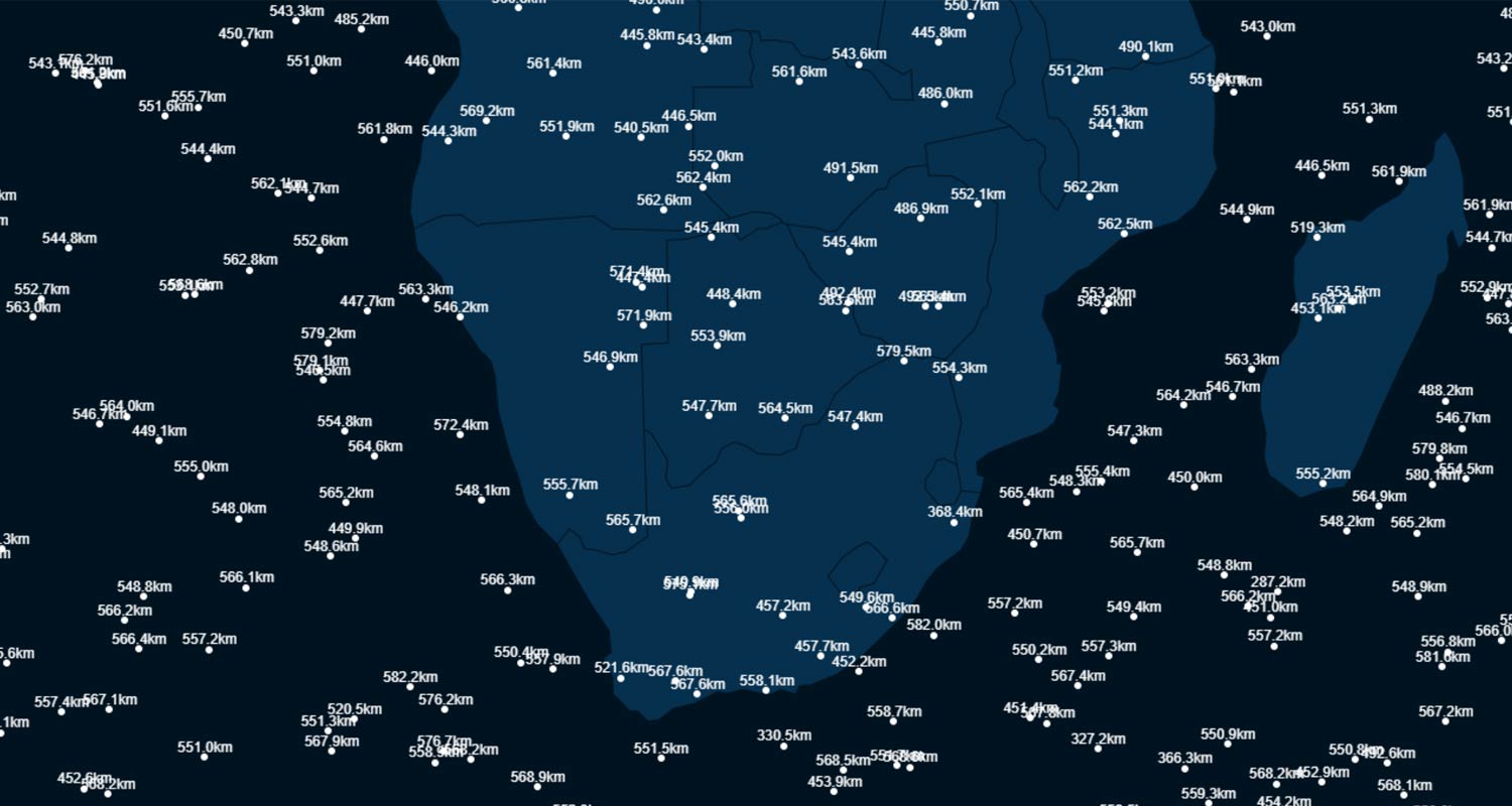
Here are some interactive map screenshots and coverage views that give you a feel for it:

Quick Tips for Getting the Most Out of It
- Head to one of the maps above (satellitemap.space is a great starting point).
- Zoom into your area — Sholapur or anywhere in India — and watch satellites cruise by.
- Play with filters for altitude or inclination if you’re feeling nerdy.
- Pair it with a visibility calculator to catch them glowing in the twilight sky.
Want to learn more about spotting those trains? This classic guide is still super helpful: How to See and Track Starlink Satellite Trains.
What’s Next for Starlink and These Maps?
SpaceX isn’t slowing down — they’re adding more satellites, testing Direct-to-Cell features, and even reconfiguring orbits for better safety. The Starlink satellite map is only going to get more fascinating as the years go by.
Here at spacetracker.live, we’re all about making space feel a little closer and more exciting. Whether you’re a casual sky-watcher or a total orbital nerd, come back often for the latest updates, tools, and breakdowns.
So go ahead — open a Starlink satellite map tab right now and see what’s orbiting overhead. It’s pretty amazing what humans have built up there.
Quick links for more: